Solutions
Electric Power Industry

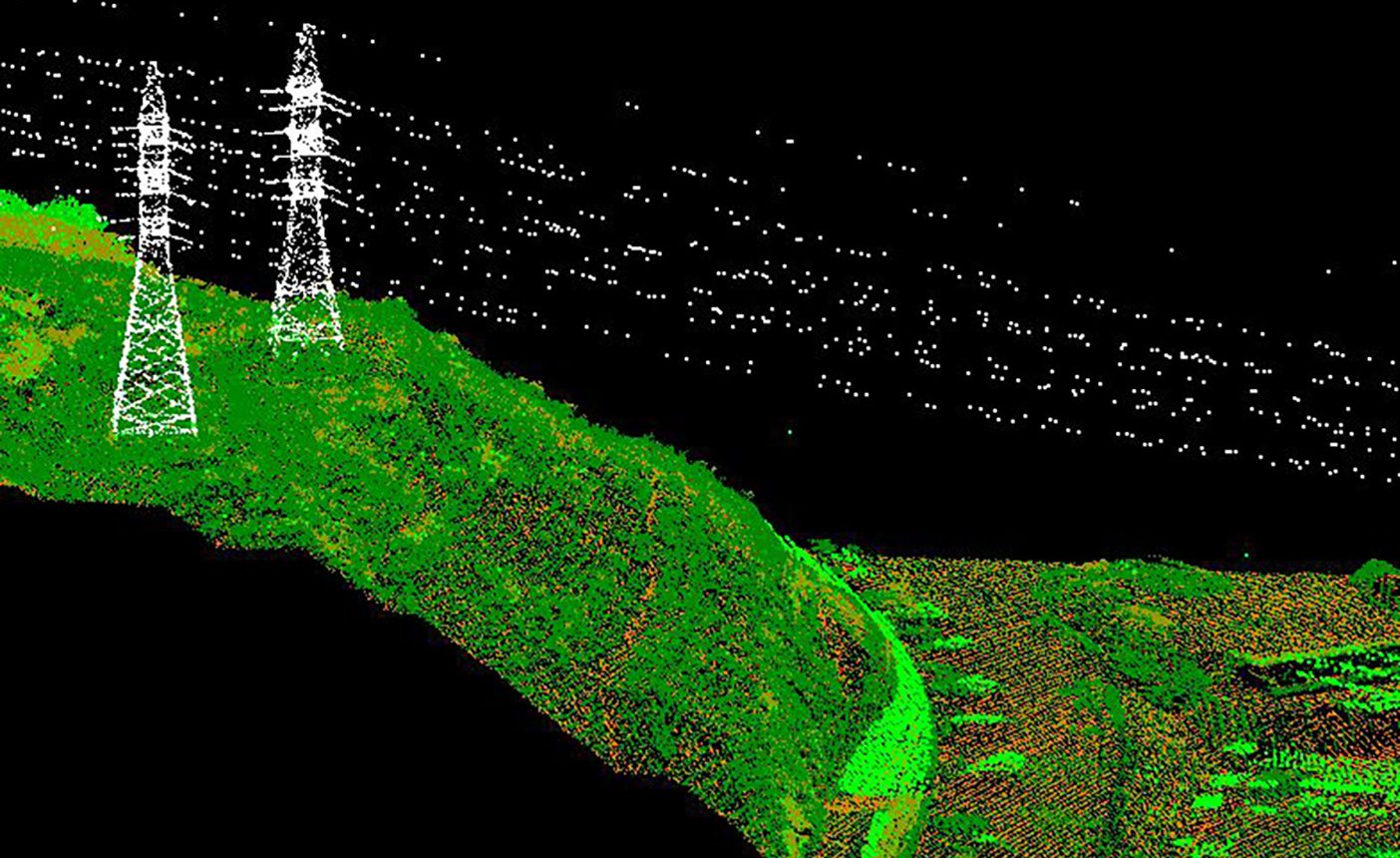
Classified points cloud
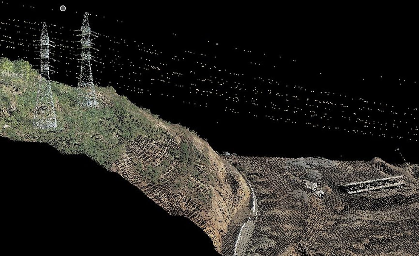
Points cloud on orthophoto backdrop
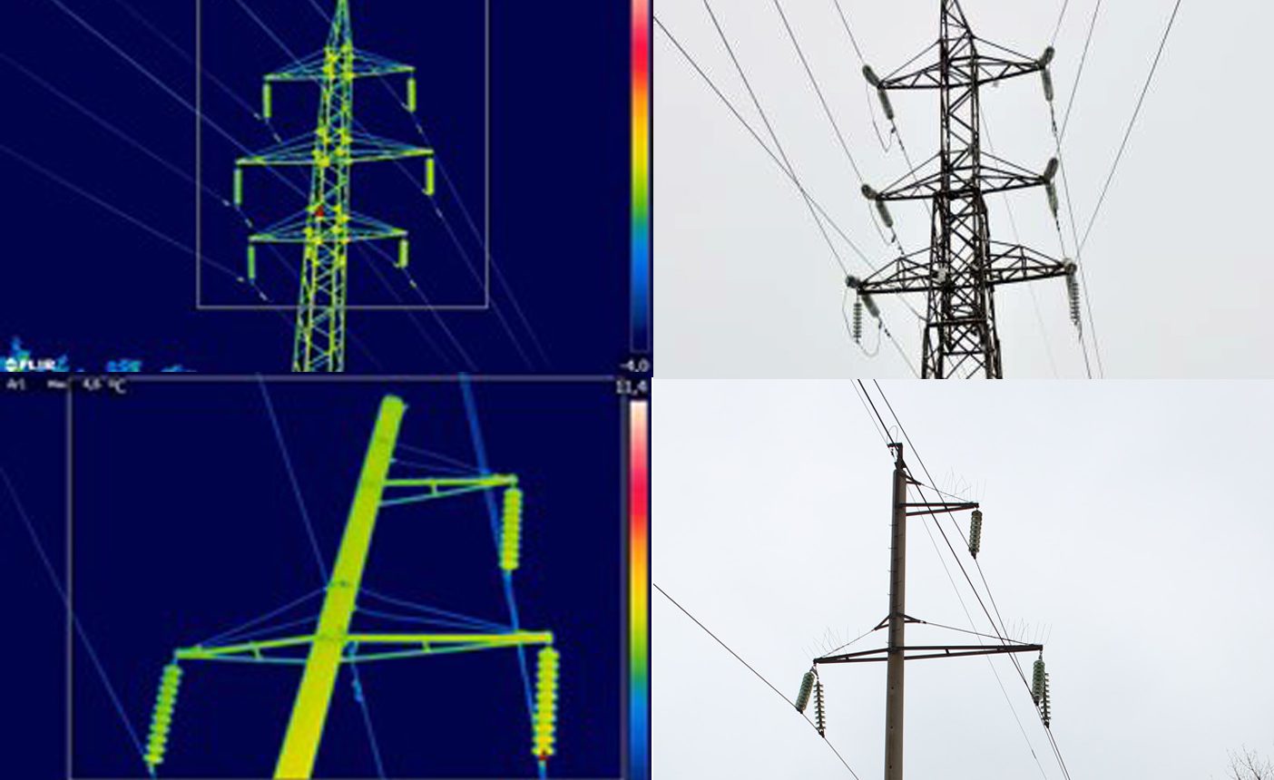
Thermograms and images of contact connections
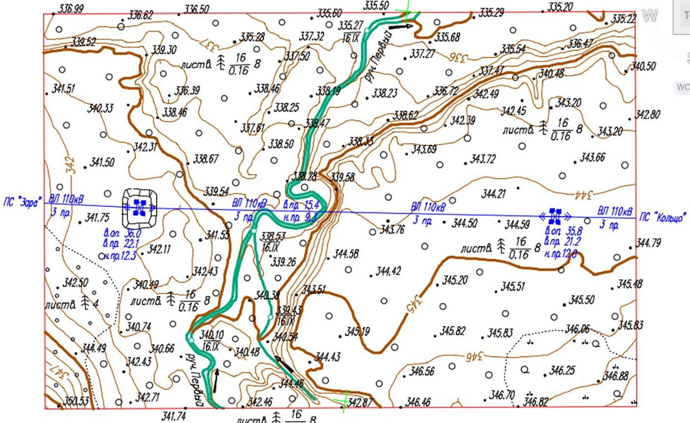
Topographic plan
Operation of power supply grids and utilities
- Inventory of power supply grids and utilities,
- Update and reissuance of the design documentation, identification of non-recorded changes,
- Certification, development of cadastral documentation.
Aerial survey and monitoring
- Diagnostics of the overhead transmission lines, insulators, contact connections and fittings,
- Accurate measurements of the power transmission line values - sagging deflection, tension,
- Assessment of the forest corridor conditions for planning of the wood clearing measures.
Engineering and Geodetic Survey
- Development of digital topographic plans,
- Development of long-term operation plans of water-storage reservoirs and water management systems,
- Development of water reservoir filling and drawdown modes.
As-built survey
- Precise and prompt comparison of the true geometric characteristics of power grid facilities, hydraulic structures, and engineering protection equipment with the designed parameters.
Forecasting and analysis of emergency consequences
- Simulation of flooding hazard areas near HPPs,
- Forecast of ice-jam and ice-dam stages,
- Precise detection of the watercourse volume, reservoir basin, landslides, taluses, volumes of ice masses, reservoir bank transformation due to the floods or anthropogenic impact.
Deliverable
- Digital topographic maps and plans of linear and area objects
of 1: 500 - 1:10 000 scale,
- Digital orthophotomaps of 1: 500 - 1:10 000 scale,
- Digital elevation models (DEM), surface models (DSM), 3D models of industrial facilities,
- Thermograms of power transmission line elements,
- Areal images,
- Cadastral plans and land management documentation,
- 2D or 3D topographic base for corporate management and control platform, GIS, and different applications.
of 1: 500 - 1:10 000 scale,
Sigma Metrix © 2013-2021
Solutions
Electric Power Industry
Classified points cloud
Points cloud on orthophoto backdrop
Thermograms and images of contact connections
Topographic plan
Operation of power supply grids and utilities
- Инвентаризация объектов электросетевой инфраструктуры
- Восстановление проектной документации и определение незадокументированных изменений
- Паспортизация, создание кадастровой документации
Aerial survey and monitoring
- Диагностика воздушных линий, изоляторов, контактных соединений и арматуры
- Проведение точных измерений параметров ЛЭП — стрел провиса, тяжения проводов
- Assessment of the forest corridor conditions for planning of the wood clearing measures.
Engineering and Geodetic Survey
- Создание цифровые топографических планов
- Создания перспективных планов эксплуатации водохранилищ и водохозяйственных систем
- Создания режимов специальных пропусков, наполнения и сработки водохранилищ
As-built survey
- Точное и быстрое сравнение истинных геометрических характеристик объектов электросетевого хозяйства, гидротехнических сооружений и средств инженерной защиты с запроектированными параметрами
Forecasting and analysis of emergency consequences
- Simulation of flooding hazard areas near HPPs,
- Forecast of ice-jam and ice-dam stages,
- Precise detection of the watercourse volume, reservoir basin, landslides, taluses, volumes of ice masses, reservoir bank transformation due to the floods or anthropogenic impact.
Deliverable
- Digital topographic maps and plans of linear and area objects of 1: 500 - 1:10 000 scale,
М 1:500 — 1:10 000
- Digital orthophotomaps of 1: 500 - 1:10 000 scale,
М 1:500 — 1:10 000
- Цифровые трехмерные модели рельефа, местности, промышленных объектов
- Термограммы элементов ЛЭП
- Аэрофотоснимки
- Кадастровые планы и землеустроительная документация
- 2D- или 3D-геоподоснова для корпоративных платформ управления, ГИС и прикладных сервисов
Sigma Metrix © 2013-2021