Solutions
Mining Industry

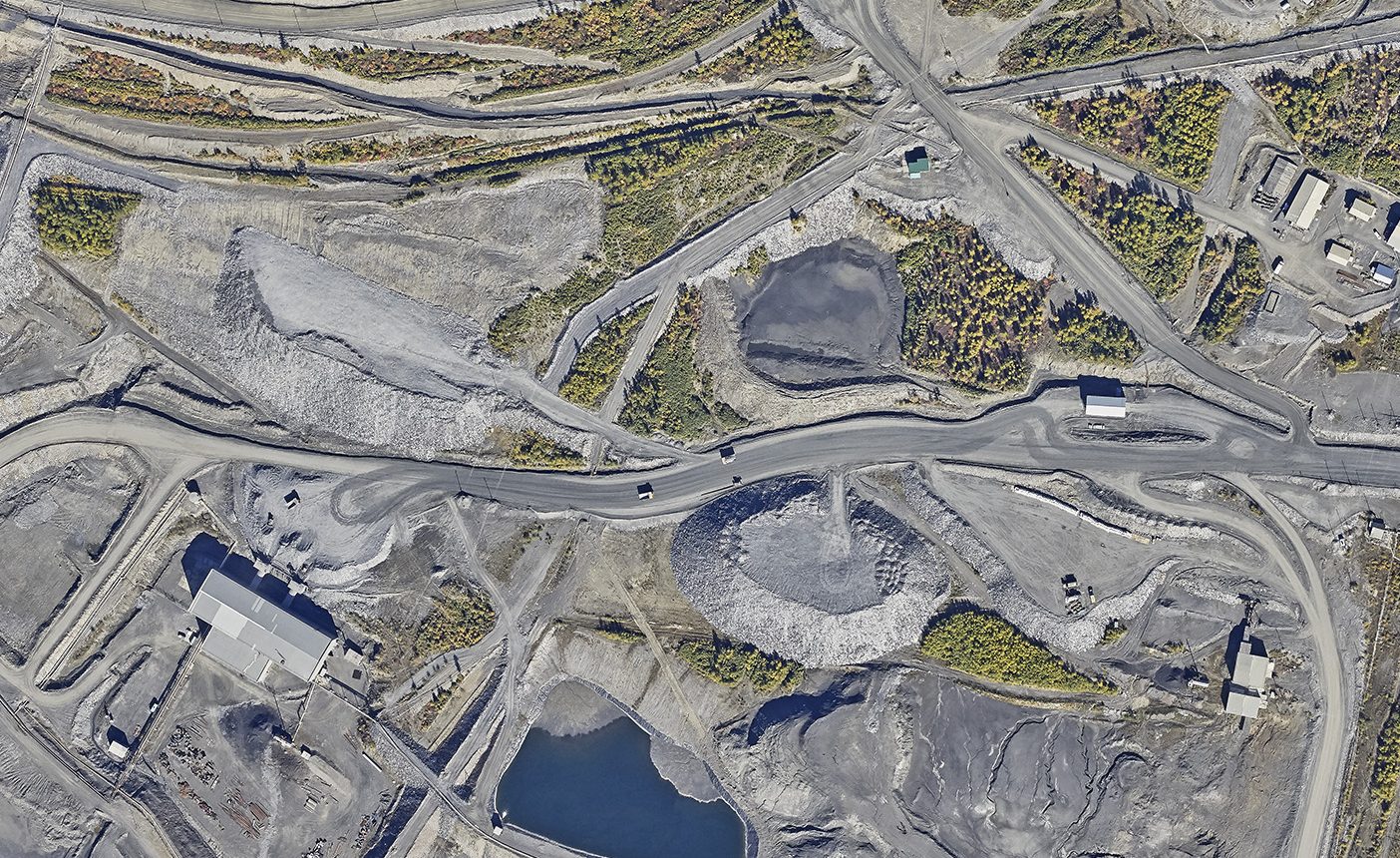
Fragment of areal image
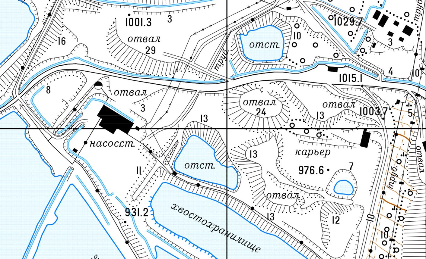
Topographic map
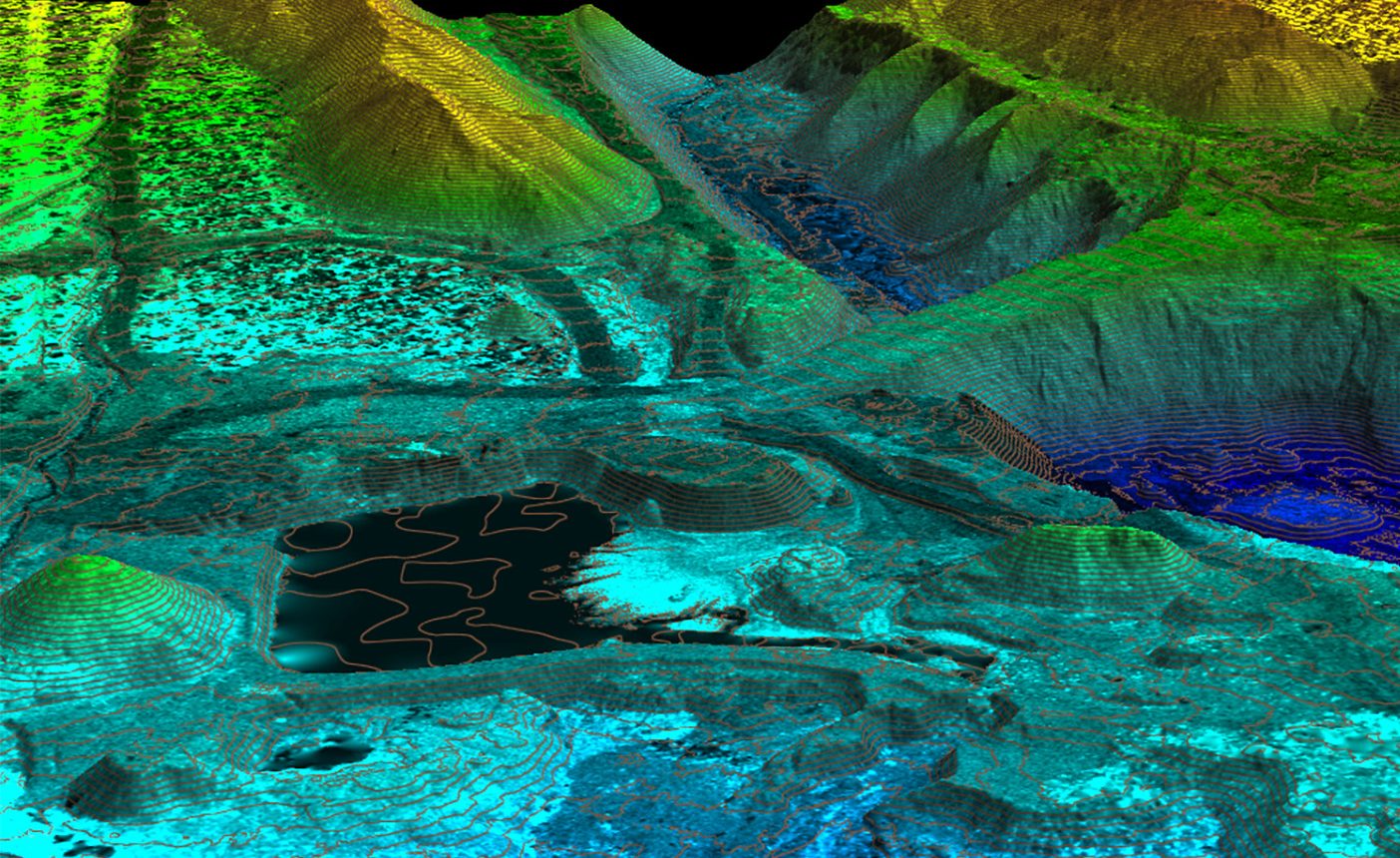
Digital elevation model,
height coded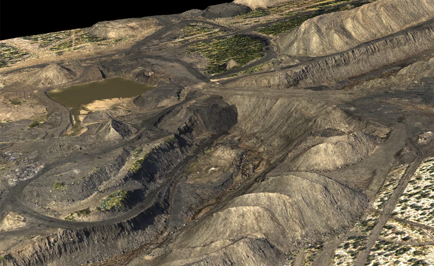
Digital elevation model,
texturized with aerial images
Aerial photography and laser scanning of opencast mining
- Mapping of the territory on a scale from 1: 500 to 1:10 000,
- The inventory of land and property fund,
- Spatial and geometric measurements, determination of the site areas and volumes – quarries, dumps, tailings,
- Construction of longitudinal and transverse profiles,
- Calculation of rock volumes (ore, slag, etc.) in dumps, warehouses, and storages,
- Provision of the geodetic base for engineering surveys,
- Preparation of engineer-constructing and as-built documentation,
- Stakeout and referencing of minings, geophysical and other points of engineering surveys,
- Update and reissuance of mining documentation.
Monitoring and preventive analysis
- Monitoring of the mining allotment condition and substantiation of their limits,
- Emergency simulation for forecasting, risk assessment, prompt response and prevention of consequences,
- Determination of hazardous areas and development of environmental protection measures against the impact of the mining plant,
- Geotechnical monitoring to detect areas with exogenous geological processes,
Deliverable
- Digital topographic maps and plans of linear and area objects of 1: 500 - 1:10 000 scale,
- Digital orthophotomaps of 1: 500 - 1:10 000 scale,
- Digital elevation models (DEM), surface models (DSM), 3D models of industrial facilities,
- Areal images,
- Cadastral plans and land management documentation,
- 2D or 3D topographic base for corporate management and control platform, GIS and different applications,
- GIS of mining companies.
Sigma Metrix © 2013-2021
Solutions
Mining Industry
Fragment of areal image
Topographic map
Digital elevation model,
height codedDigital elevation model,
texturized with aerial images
Aerial photography and laser scanning of opencast mining
- Mapping of the territory on a scale from 1: 500 to 1:10 000,
- Инвентаризация земельно-имущественного фонда
- Пространственно-геометрические измерения, определение площадей и объемов объектов — карьеров, отвалов, хвостохранилищ
- Построение продольных и поперечных профилей
- Вычислению объемов породы (руды, шлака и т.д.) на отвалах, складах и хранилищах
- Обеспечения геодезической основой инженерных изысканий
- Подготовка проектно-строительной и исполнительной документации
- Вынос в натуру и привязка горных выработок, геофизических и других точек инженерных изысканий
- Обновление и восстановление горнографической документации
Monitoring and preventive analysis
- Наблюдения за состоянием горных отводов и обоснование их границ
- Моделирование чрезвычайных ситуаций с целью прогнозирования и оперативного предотвращения их последствий
- Определение опасных зон и разработка мер по охране природных объектов и строений от воздействия горнодобывающего предприятия
- Геотехнический мониторинг с целью обнаружения участков с проявлением экзогенных геологических процессов
Deliverable
- Цифровые топографические карты и планы линейных и площадных объектов М 1:500 — 1:10 000
- Цифровые ортофотопланы М 1:500 — 1:10 000
- Цифровые трехмерные модели рельефа, местности, промышленных объектов
- Аэрофотоснимки
- Кадастровые планы и землеустроительная документация
- 2D- или 3D-геоподоснова для корпоративных платформ управления, ГИС и прикладных сервисов
- ГИС горнодобывающих предприятий
Sigma Metrix © 2013-2021