Solutions
Oil & Gas Industry

Fragments of the orthophotomap
Digital terrain model
Karstic phenomenon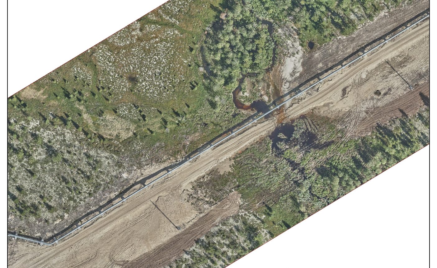
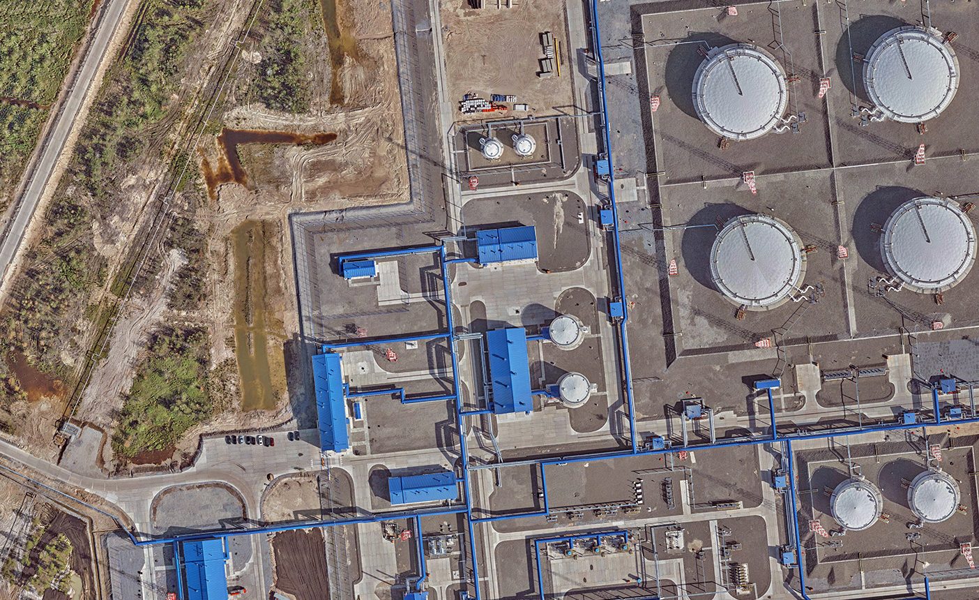
Orthophotomap
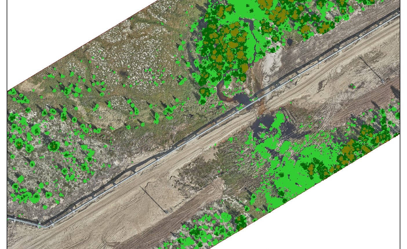
Digital model of vegetation
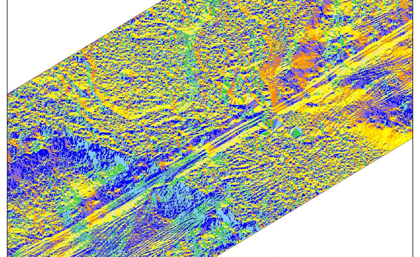
Slope exposure map
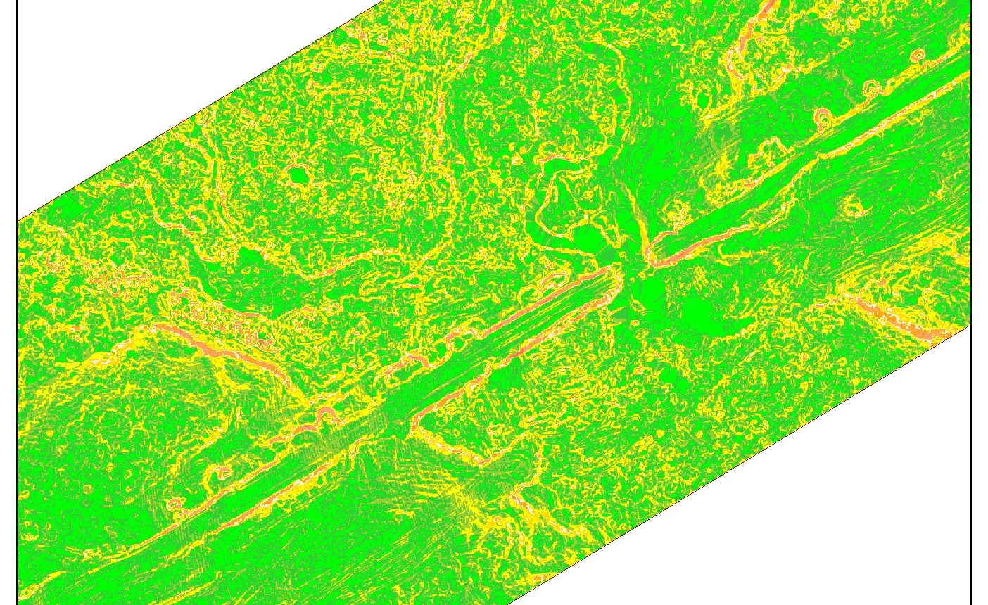
Slope map
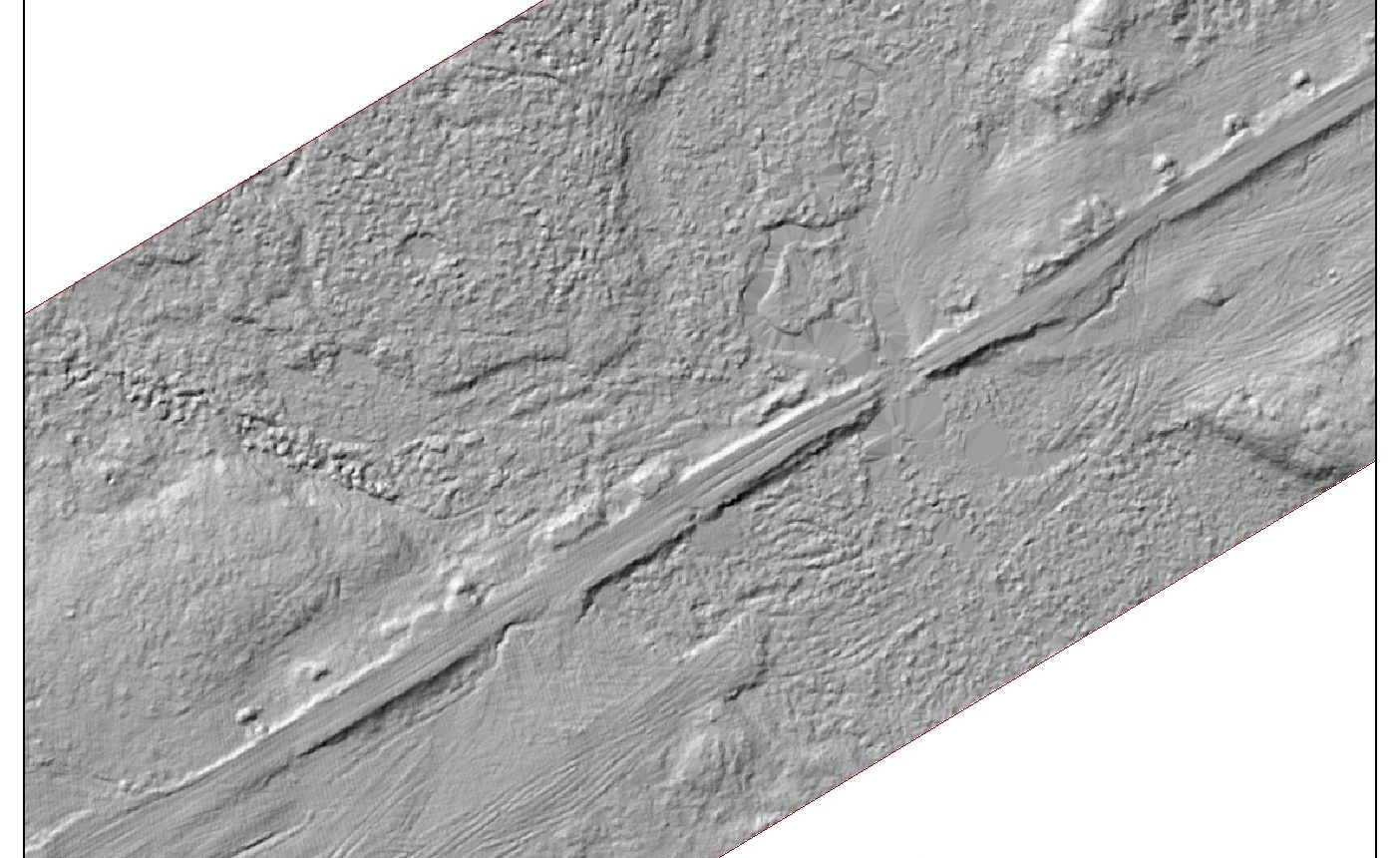
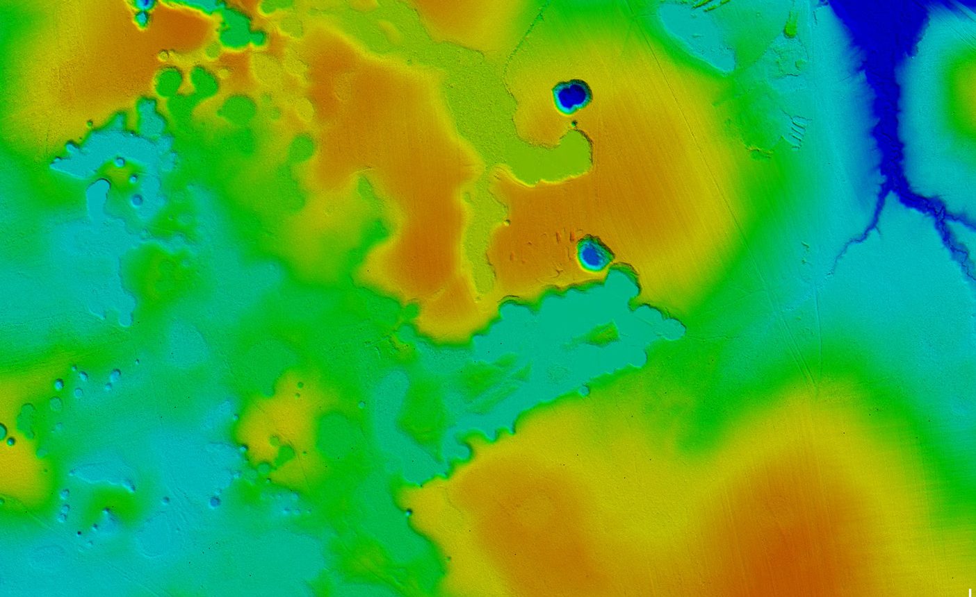
Hill shading
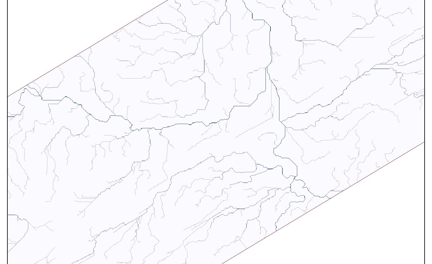
Surface flow accumulation map
Oil and gas industry operation
- Mapping of the territory on a scale from 1: 500 to 1:10 000,
- The inventory of land and property fund,
- Development of the unified digital reference cartographic base at the most detailed level,
- Inspection of the technical condition of engineering facilities - trunk pipelines, field infrastructure facilities, etc.
- Certification of engineering structures - oil and gas field facilities, oil refineries,
- Update and reissuance of technical documentation.
Engineering objectives
- Laser scanning, classification of laser reflection points, construction of longitudinal and transverse profiles, generation of 3D models of oil and gas infrastructure objects,
- Provision of the geodetic base for engineering surveys,
- Survey of underground utilities and generation of digital 3D models,
- Development of the local satellite geodetic networks at the oil and gas fields along main pipelines
Monitoring and simulation
- Monitoring of man-induced processes at oil and gas production facilities,
- Monitoring of settlements and deformations of buildings and structures,
- Geotechnical monitoring to detect areas with exogenous geological processes,
- Emergency simulation for forecasting, risk assessment, prompt response and prevention of consequences.
Deliverable
- Digital topographic maps and plans of linear and area objects: pipelines, fields and exploration territories, tank farms, oil refineries,
- Digital orthophotomaps of 1: 500 - 1:10 000 scale,
- Digital elevation models (DEM), surface models (DSM), 3D models of industrial facilities,
- Areal images,
- Cadastral plans and land surveying documentation,
- 2D or 3D topographic base for corporate management and control platform, GIS and different applications,
- GIS of oil & gas facilities.
Sigma Metrix © 2013-2021
Solutions
Oil & Gas Industry
Fragments of the orthophotomap
Digital terrain model
Karstic phenomenonOrthophotomap
Digital model of vegetation
Slope exposure map
Slope map
Hill shading
Surface flow accumulation map
Oil and gas industry operation
- Mapping of the territory on a scale from 1: 500 to 1:10 000,
от 1:500 до 1:10 000 - Инвентаризация земельно-имущественного фонда
- Создание единой цифровой картографической основы с максимальной детализацией
- Инспекция технического состояния инженерных объектов — магистральных трубопроводов, объектов инфраструктуры месторождений и пр.
- Паспортизация инженерных сооружений — нефте- и газопромысловых объектов, НПЗ
- Обновление и восстановление технической документации
Engineering objectives
- Лазерное сканирование, классификация точек лазерных отражений, построение продольных и поперечных профилей, создание 3D-моделей объектов нефтегазовой инфраструктуры
- Обеспечения геодезической основой инженерных изысканий
- Съемка подземных коммуникаций и создание их цифровых моделей
- Создание локальных спутниковых геодезических сетей на месторождениях газа и нефти, вдоль магистральных трубопроводов
Monitoring and simulation
- Мониторинг техногенных процессов на объектах добычи нефти и газа
- Мониторинг осадок и деформаций зданий и сооружений
- Геотехнический мониторинг с целью обнаружения участков с проявлением экзогенных геологических процессов
- Emergency simulation for forecasting, risk assessment, prompt response and prevention of consequences.
Deliverable
- Цифровые топографические карты и планы линейных и площадных объектов: трубопроводов, промысловых и разведочных территорий, резервуарных парков, НПЗ
- Цифровые ортофотопланы обширных территорий
- Цифровые трехмерные модели рельефа, местности, промышленных объектов
- Аэрофотоснимки
- Кадастровые планы и землеустроительная документация
- 2D- или 3D-геоподоснова для корпоративных платформ управления, ГИС и прикладных сервисов
- ГИС объектов нефтегазового комплекса
Sigma Metrix © 2013-2021