Aerial photography and
laser scanning of Cities
The territory of the Republic of Tatarstan, Voronezh region and 14 cities: Kaliningrad, Baltiysk, Yekaterinburg, Rostov-on-Don, Almetyevsk, Zelenodolsk, Naberezhnye Chelny, Kazan, Omsk, Chelyabinsk, Magnitogorsk, Astrakhan
2017-2020
Customer
Roscartography JSCProject mission
-
Airborne survey and creation of 1:2000 orthophotomaps to be included in the State Unified Digital Reference Cartographic Base as part of the national project “Digital Economy of Russian Federation”
Surveyed area
14500sq. km
Cities
14
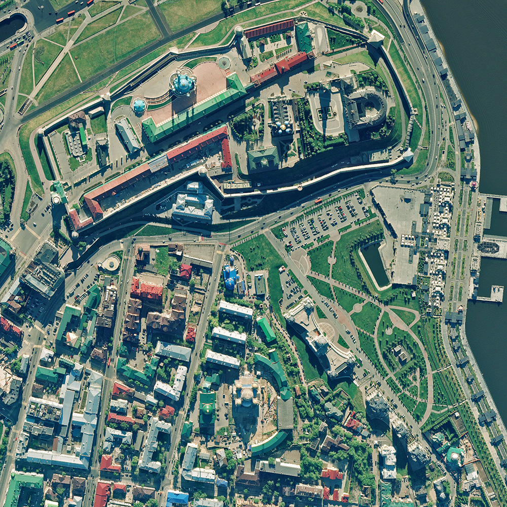
Kazan. Nadir image
Zoom in to see the level of detail
Deliverable
- Digital Elevation (DEM) and Terrain (DTM) models of 1: 2000 scale;
- Digital orthophotomaps of 1: 2000 scale.


Project details
The Unified Digital Reference Cartographic Base (UDRCB) is a systematized geospatial data set for specific territory. It contains information about hydrography and hydro-technical utilities, settlements, industrial, agricultural, and social and cultural facilities, highway and road systems and infrastructure, vegetation and soils, national and administrative boundaries, and geographical names. The data obtained as a result of UDRCB development:- will be the basis for the Unified State Register of Real Estate;
- will be integrated into the Federal Monitoring System of the social and economic development of the Russian settlements;
- will enable to provide new services within the framework of the Digital Economy Program;
- will also be used for addressing the territorial planning issues in Russia and attracting the investments to the regions.