Aerial photography
Aerial photography allows for obtaining images of the earth's surface with
an image resolution of up to 2.5 cm.
Just imagine that you can see
every daisy in the field in an image
taken at a height of 1 km.
State-of-art digital aerial cameras capture data in several channels - PAN, RGB, CIR.
The most advanced cameras combine nadir lenses, which make images of the surface exactly from above at the right angle, and oblique lenses for data acquisition in the angular projection. That is particularly important for 3D city modeling.
What is the point?
Maps of small to large scales. For topographic mapping and CAD/GIS projects - in areas as diverse as transportation, urban planning, environment, resource management.
3D city modeling. For detailed visual representation of the built environment, allowing interaction, analysis and interrogation of our urban landscapes on an unprecedented level. The data can be provided at a variety of levels of details (LoD) and is used as smart spatial integration platform for urban thematic application models.
Change Detection - the process of detecting the differences in the state of land features by observing them at different times. It is extremely important for understanding relationships and interactions between human and natural phenomena to promote better decision-making. It is important for preventing and managing emergencies, for example in case of drift sands.
Forest inventory based on infrared images.
And much more...
Advantages of the manned aerial photography
As compared to the satellite imagery:
- Higher resolution and images quality.
- The ability to simultaneously carry out both aerial photography and LiDAR survey, which is crucial important for correct 3D modeling and creation of DSM and DTM products.
- Nadir and oblique aerial photography in one flight - obtaining orthographic view data for mapping and high quality oblique images for 3D models textures.
As compared to the UAV imagery:
- Aerial photography of large areas at high speed - increased productivity and reduced expenditures.
- Images quality and geodetic coupling accuracy under the manned aerial photography with a metrical large format camera are significantly better.
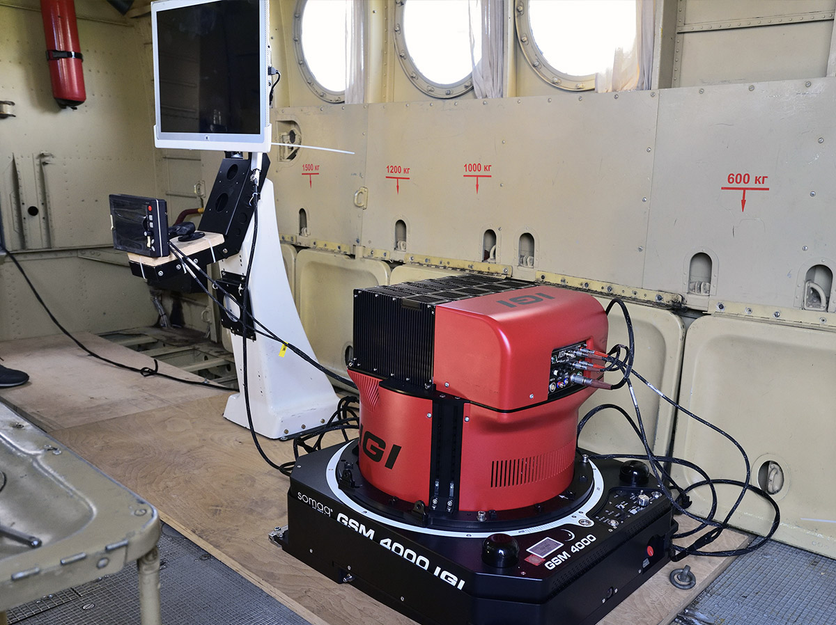
Sigma Metrix has
the best technical equipment in Russia
This enables
To simultaneously and quickly carry out projects in different regions, which is important for a short field season.
This ensures
The high quality of received data - we are sure that our equipment is record-breaking in terms of its technical characteristics and productivity, and the data captured using this equipment are of the highest quality and rich.