Engineering and geodetic survey.
Front-end engineering design
for rehabilitation of
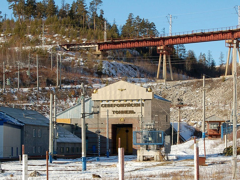
the Severomuysky Tunnel
Republic of Buryatia
2019
Project mission
Engineering and geodetic survey within the framework of the front-end engineering design for rehabilitation of the track structure and the drainage and transport adit of the Severomuysky Tunnel.Customer
JSC "Russian Railways",Director's Office for communications network engineering
Equipment
- LiDAR system IGI LiteMapper VQ 7800II
- PhaseOne 150 mp camera
237sq. km
Surveyed area
The IGI Lite Mapper Air Scanning System emits pulses with a frequency of 150-2000 kHz and provides the unprecedented density of laser point clouds 30 points per square meter at an altitude of 600 m.
The important characteristic of LiDAR is the possibility to seamlessly survey 17 MPiA zones, which allows an even distribution of points along the entire width of the surveying lane. This provides better data for wooded areas and improves the post-processing recognition of terrain and low vegetation.
The construction features of the IGI LiteMapper allows for survey at high altitudes and thus to map more extensive areas per flight and to survey the areas with complicated high-mountainous terrain.
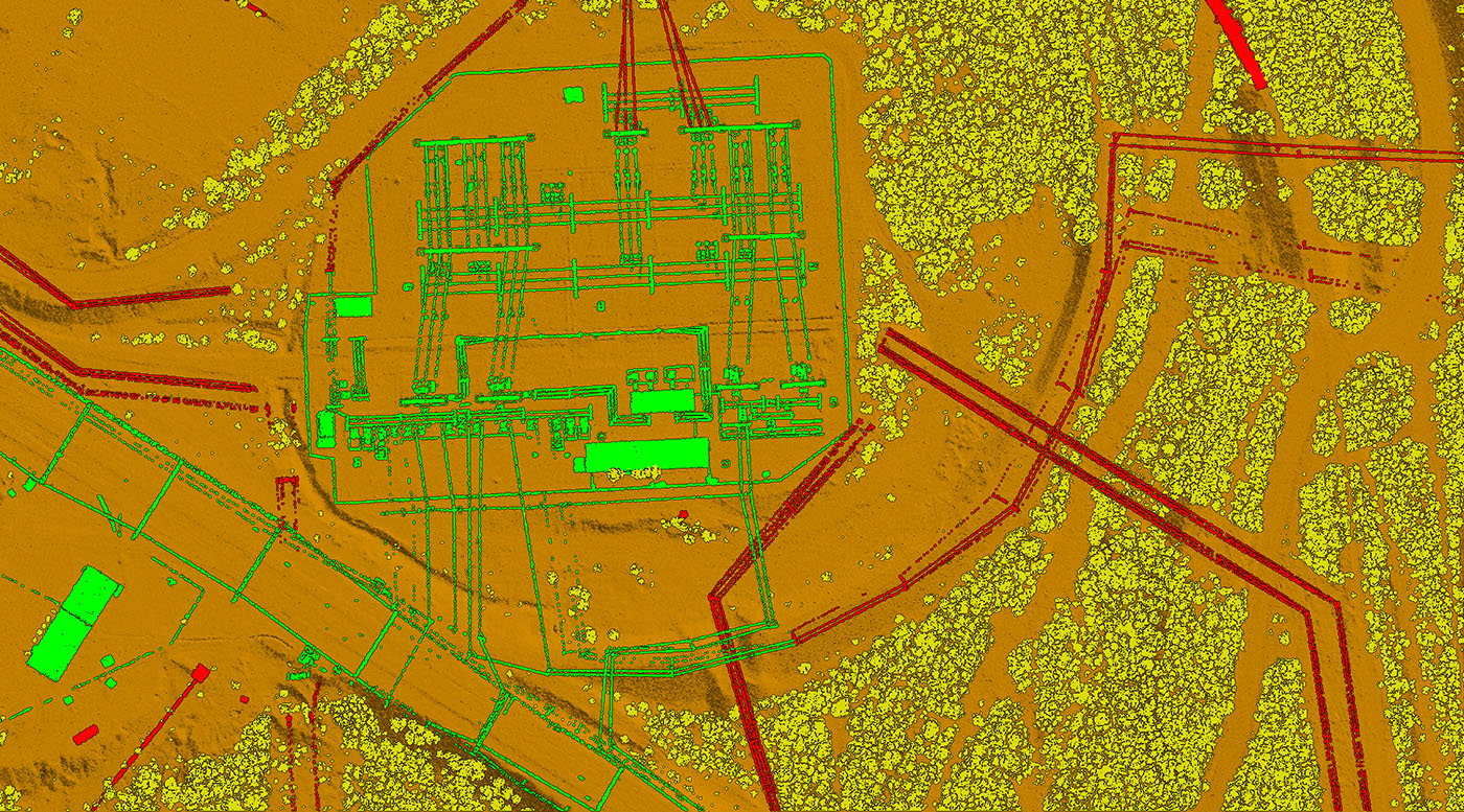
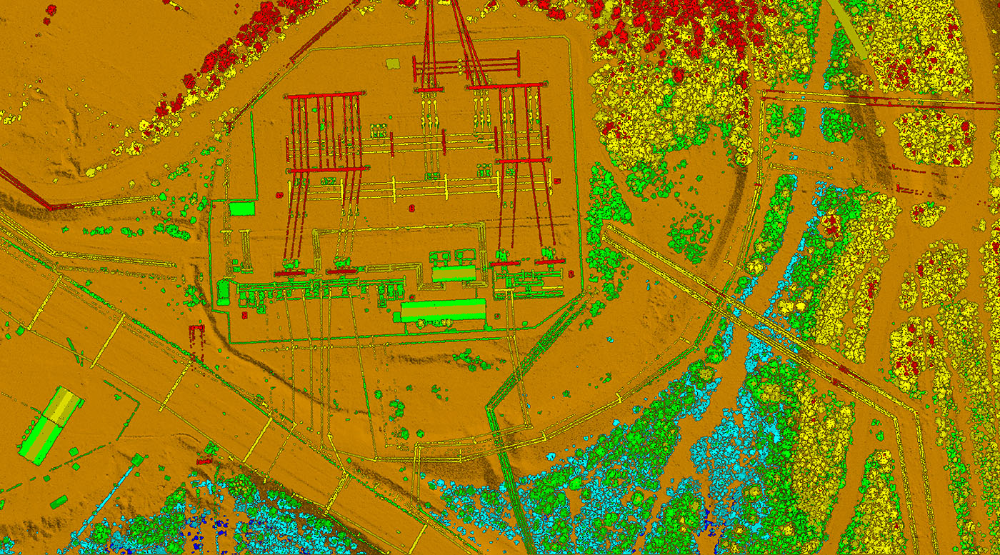
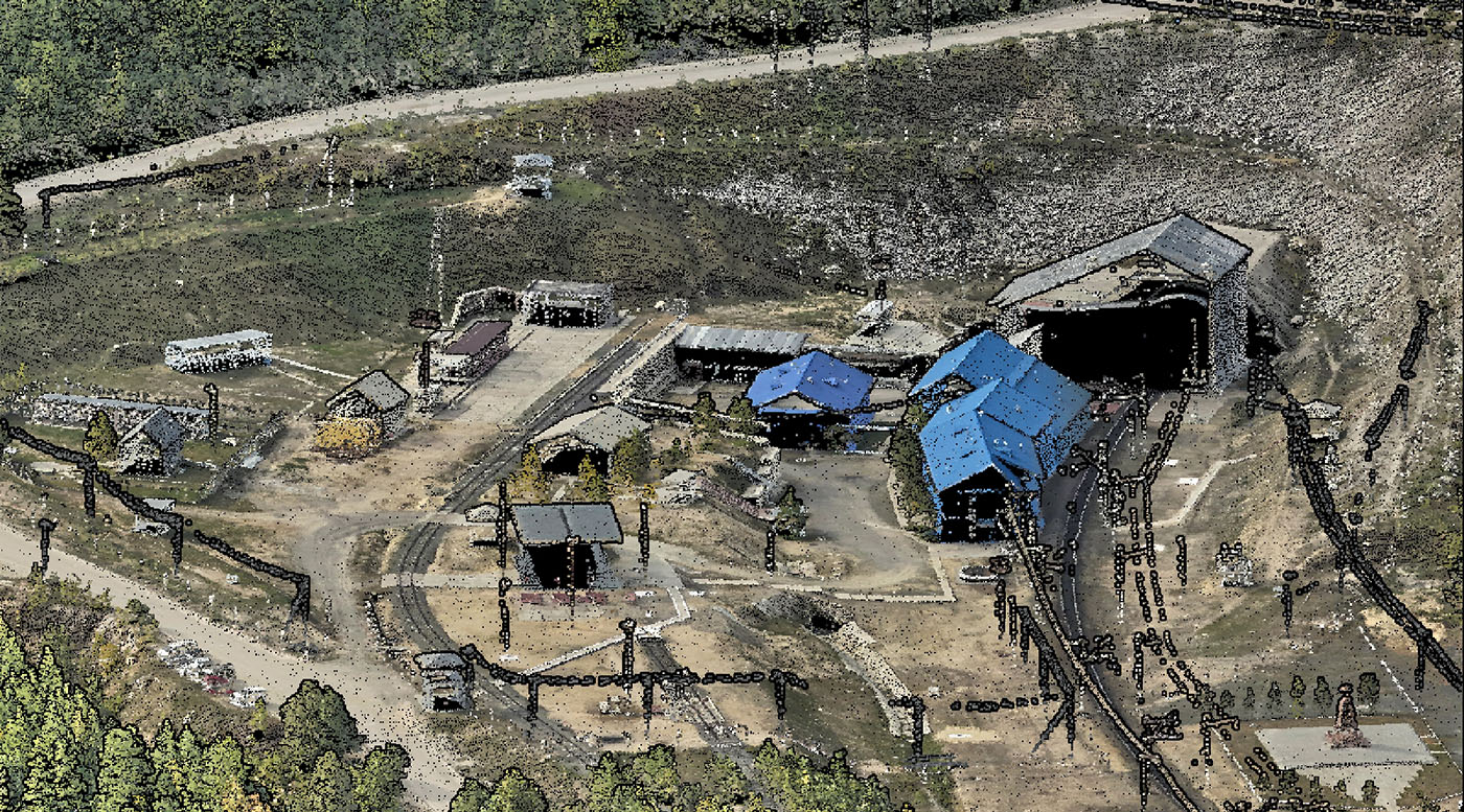
Points cloud

Orthophotomap
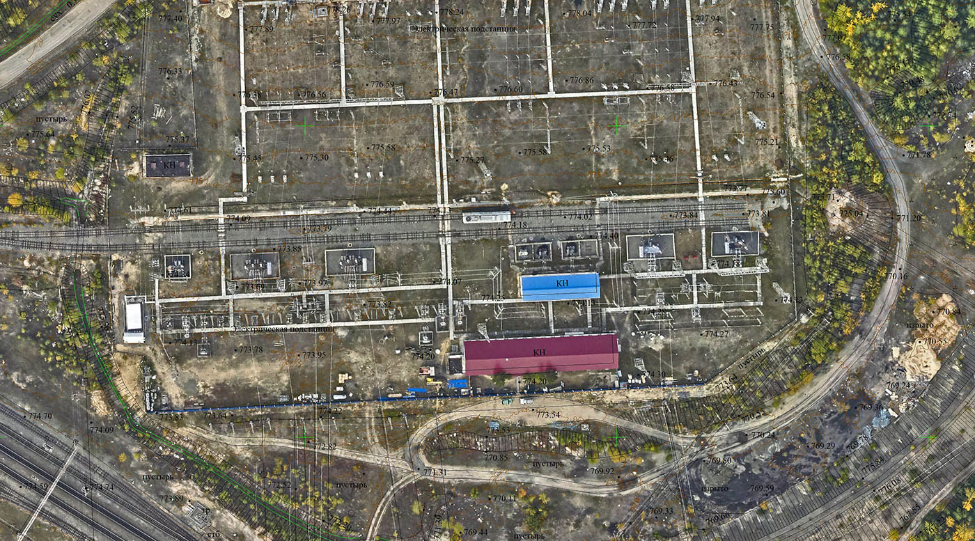
Topographic plan on orthophotomap backdrop
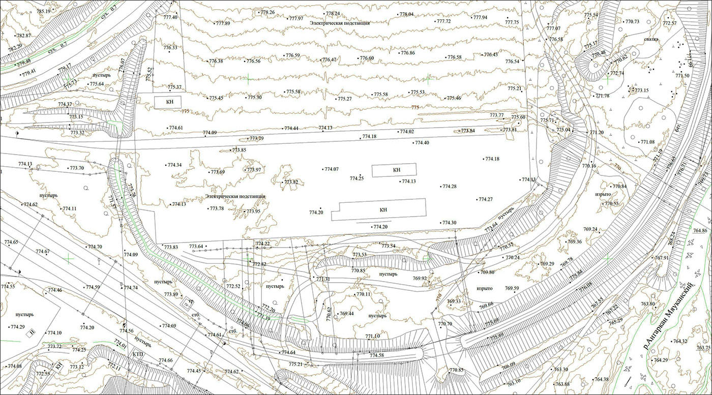
Topographic plan
Deliverable
- Classified laser scanning points,
- Digital orthophotomaps of 1: 1000 scale with 10 cm pixel size on the ground,
- Engineering digital elevation model with an accuracy of +/- 10 cm in elevation,
- Engineering digital terrain model,
- Digital engineering topographic plan of 1: 1000 scale with a contour interval of 0.5 m.